Defining Penang Exceptionalism Through Its Geography, Its Biology and Its Human History

By Dato’ Dr. Ooi Kee Beng

June 2025 EDITORIAL
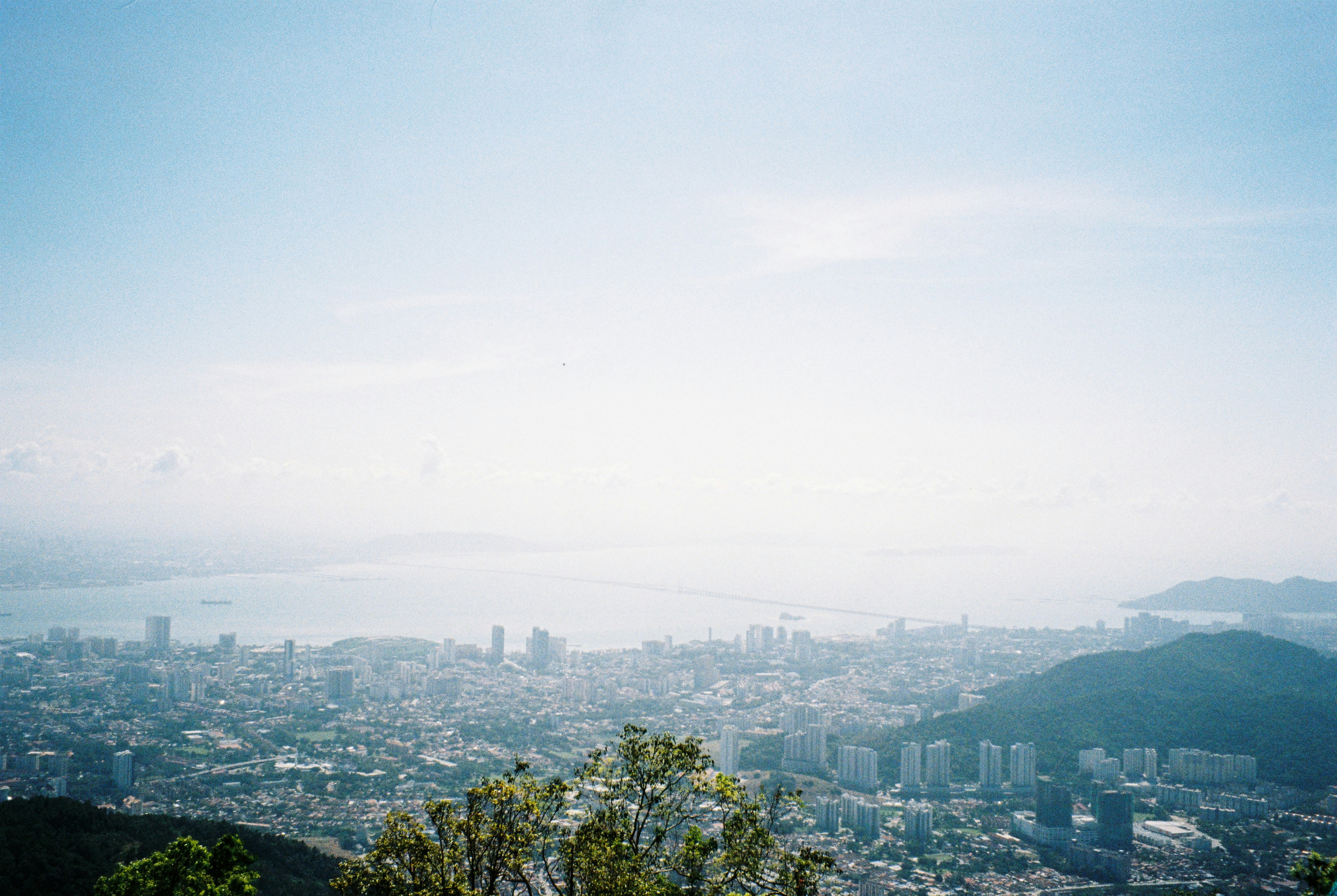
main image
Photo by miza mila on Unsplash.
Advertisement

“DOES PENANG EXCEPTIONALISM still exist?” That question was put to me recently by a learned and slightly agitated visitor.

I assume the query stems from distress over how recent developments in the state have been too much, too hasty and too uncontrolled. It is a valid worry—and also an increasingly common one. The speedy spreading of built environment in Penang is real enough. While some see this as economic success and necessity, others hear the death knell of an environmental and cultural paradise.

It got me thinking about what it is that is being lost, exactly, and whether the process can be reversed.

One trait in people from Penang is that they are passionate about the place. Besides being their home, it is almost a holy place to them—a blessed place that inspires, attracts and awes most visitors. I remember Penang people decades ago would brush off glib criticisms about their love of the place with the glib remark that “it’s the water we drink”.

That comment may actually carry more meaning than they imagined.

Let me attempt a response that is more considered and broad, and that, at the same time, accentuates Penang’s historical, physical and geographical realities. Whatever I put forth will, in most other eyes, be subjective, more reflective of my own worldview than anything else.

Firstly, being a small island situated at the northern end of the Malay Peninsula and at the entrance into the Strait of Malacca, Penang exhibits signs of geological and marine forces that had been at work millennia ago. The Penang Strait, 2.4km at its narrowest, makes the island’s connection to the peninsula undeniable. It is an island, but stays closely attached to the rest of the world.

If I stand atop the range of hills in the middle of the island, and look south-east, I cannot help seeing the lower series of highlands rolling away in that direction. There are the Paya Terubong hills lying between this main range and the eastern coastline, and then there is the islet of Pulau Jerejak standing a few hundred metres off the shore. Beyond it are the islets of Pulau Aman and Pulau Gedung. Then, come the faraway but visible hills of the mainland. What strikes the casual observer is that these ridges run parallel from north to south, aligned both to the peninsula’s general layout and reflective of the flow of strait currents.

This easy observation says something important about the splendor of Penang’s natural location and its physical surroundings. Its geological environment remains evident, as yet unhidden by its expanding built environment, as has been the case in most other big cities not properly planned. Penang was never properly planned, and yet its seas and hills continue to complement each other, comforting and benign.

Secondly, for 250 years, the West has met the East here, the latter in its major forms: Chinese, Indian, Middle-eastern and archipelagic. The modern has had to adapt to the old, and vice versa, resulting in hybrids of all kinds.

Thirdly, while population growth has greatly affected the cape that now houses George Town and the northern coastline, along with the plains to the east and west of Penang’s hill range, the highlands remain visibly green even if occasionally threatened by eager developers. They continue to act as a vibrant and verdant backdrop that softens the intrusion of the tall buildings that now make up the cityscape and cover the original floodplains.

Significantly, in September 2021, over 12,000ha in the northwestern part of the island, and extending into the sea, gained recognition from UNESCO, which named it a Biosphere Reserve. This followed the July 2008 listing of George Town as a UNESCO Heritage Site. Furthermore, in recent years, as part of the state government's Penang2030 vision, plans have been afoot, driven by Penang Institute and Universiti Sains Malaysia, to preserve the Middle Bank stretch of sea lying between the island and the mainland as a marine sanctuary for biodiversity studies and research.

These phenomena, both natural and human, tell us much about how people residing in Penang cannot help but stay forever cognisant of the past. To them, these tracings of the flow of time remain evident in their everyday surroundings. These are clad in the biological diversity they gave birth to; this diversity in turn sustains the cultural miscellany settled on the plains of the island.

The visible time spans etched into the landscape and the cityscape are an asset most appreciated when threatened.

As answer to the question on Penang’s exceptionalism therefore—I would say it still exists. It exists in the landscape and the cityscape, and these sustain and have given birth to the vital element determining the exceptionalism of the place, namely the deep sense of spiritual and historical ownership felt for the place by its inhabitants, and the inclusivity their society has always exhibited.

Let me end by inserting the concept of “Dragon veins” into our discussion. The landscape and cityscape of any place manifest the flow of time. They do so in abundance in Penang, and on a scale perceivable for most people. Having had that for so long, its people consider the place exceptional. And therefore it remains exceptional, and they will struggle to keep it that way.

Wherever humanity and nature can converse, that place is exceptional. And that conversation must not be allowed to stop.

*Note: “Dragon veins” is a Chinese poetic reminder of the flows of time and energy captured in the physical world, evident here and now to those sensitive enough to see them. Understood as an aesthetic concept, the cutting of these veins destroys the history, the beauty and the exceptionalism of a place.

Dato’ Dr. Ooi Kee Beng

is the Executive Director of Penang Institute. His recent books include The Eurasian Core and its Edges: Dialogues with Wang Gungwu on the History of the World (ISEAS 2016). Homepage: wikibeng.com


`