Bukit Mertajam: The Mount That Decides Borders
By Eugene Quah
June 2025 COVER STORY
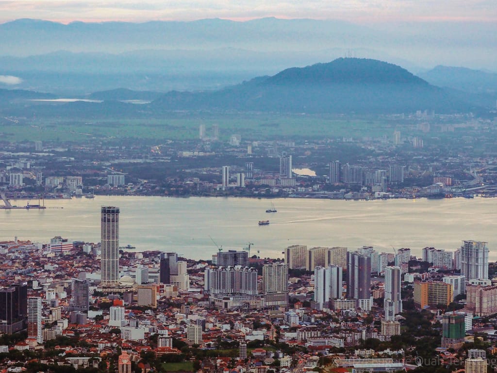
“KEEP YOUR PISTOL cocked and ready, tuan, when you see me uncover my kris, as we pass through the blukar (scrub), for many a man have I known to be set upon here...” warned Oamut [Ahmad] to James Turnbull Thompson as they made their way back to British territory.
The travel companions were a retired Malay soldier who served in the Ceylon[1] Rifle Corp and a young land surveyor employed by his relative, David Wardlaw Brown of Gelugor, to survey the latter’s vast estates. Thomson—just shy of his 18th birthday—challenged himself to map the sparsely populated Province Wellesley, now known as Seberang Perai. Oamut—a local from Bukit Tengah—was his guide. They had briefly stopped at a place called Kota (Malay for fort) located within Siamese territory. “We passed over the boundary... all safe; and, after a breakfast of rice, curried fowl and plantain [banana], we mounted the elephant and set out on our journey to Bukit Moratajam[2] [from Permatang Pasir],” wrote Thomson in his memoir.
“We soon rose over the plain, and found ourselves on top of a hill called Bukit Indramuda,” according to Thomson, “covered with clove trees and plantain gardens, the property of some enterprising Chinese settlers. Here we could scan the whole province, from the Krean [River] to the Muda [River].” Thomson asked Oamut if he knew who owned the various plantations and was told that they all belonged to the “East India Company’s Chief Official”—a Scotsman named James Low. Captain Low (later Colonel Low) had been put in charge in 1826 as Superintendent of Lands of the Province Wellesley.[3]

Foot of the Big Hill
The pair continued their journey, passing through the swamps of Kubang Semang (Hollow of the Semang) towards the great hill in the distance. The Semang, an indigenous Orang Asli group of hunter-gatherers, were early inhabitants around Bukit Mertajam. (See Penang Monthly June 2024 issue)
Along the way, Thomson dozed off on the elephant. However, his Malay friend later nudged him awake, as “the pepper gardens of Bukit Moratajam were now in view”. Oamut had “many acquaintances amongst the Chinese here”. They “stopped at headman’s house at mid-day”, where they were “hospitably regaled with rice, salt fish, tea and sweetmeats”, wrote Thomson. It seems that there was an emerging community of Chinese residents at the base of the foothill. In Penang Hokkien dialect, the present town is known by its evocative name: Tōa-soaⁿ-kha (大山脚)—literally “Foot of the big hill”.
The founding date of the current Bukit Mertajam town remains inconclusive. An agricultural treatise published by Low in 1836—though the information appears to be from 1834—makes no mention of a settlement at Bukit Mertajam apart from the remark, “… fruits brought from the woods of Moratajam, Province Wellesley include the duku, langsat, salak and papaya”. Thus, the founding of the present town could perhaps be narrowed down to between Low’s account (1834) and Thomson’s visit (1839).

Hill of The Martajam Tree
Bukit Mertajam is a granitic mountain rising from a flat coastal plain to a height of 545m above sea level and serves as the source of the Juru River. Like many other hills and places in Malaysia, such as Bukit Jelutong, Bukit Seraya and Bukit Tambun, the peak was probably named after a particular kind of tree, which probably grew in abundance on its slopes. In this case, the Mertajam tree (Lepisanthes rubiginosa).
The Mertajam tree, native to Penang, typically grows only 2-3m tall, and produces shiny, red elliptical fruits—reputedly “unpleasantly flavoured”. According to Low, the tree’s medicinal properties were well-known to locals: “root and leaves are mashed as a cooling application, in cases of brain-fevers. The infusion of this root is drunk, incases requiring astringent medicine.”

Boundary Mountain
After leaving Bukit Mertajam, Thomson and Oamut returned to Permatang Pasir, dismounted their elephant and walked to Bagan Serai. Before parting, Thomson asked, “How long has Province Wellesley belonged to the British?”
“Upwards of a quarter of a century,” Oamut replied incorrectly—the territory had been acquired nearly four decades earlier. It was on 6 June 1800 that George Leith, Lieutenant Governor of Penang, signed a treaty with the Sultan of Kedah, which superseded the 1791 treaty.
When Thomson inquired about local administration, Oamut explained that the magistrate, tax collector and superintendent were all the same person: the “East India Company’s Official.”
“Well, I see, Oamut, that [this official]...would require to be a demigod.” Thomson’s map of Penang Island and Province Wellesley was completed in November 1839.
After Penang, Thomson would go on to work in Singapore as the Government Surveyor. He would later achieve prominence for designing and constructing the Horsburgh Lighthouse on Pedra Branca (Batu Putih).

International Border
In 1821, in a dark episode of Kedah’s history known as the Perang Musuh Bisik (The War of the Whispering Enemy), the Kingdom of Siam suddenly invaded Kedah, then a tributary state under its suzerainty. Bukit Mertajam was then part of Kedah. A “fleet carrying an army of 7,000 men under the Raja [Governor] of Ligor—Chao Phraya Nakhon Si Thammarat—sailed into the Kedah river so suddenly that Malay chiefs did not have the time to assemble their followers.” Thousands of Kedah Malays fled the massacre by the Siamese forces by crossing the Muda River into Province Wellesley.
In 1826, the EIC and Siam signed a treaty, mutually recognising Kedah, Kelantan, Perlis and Terengganu as Siamese territories, while Penang, Melaka and Singapore remained British. Article 3 was clarified in 1831 through a boundary treaty with Ligor, which expanded Province Wellesley as follows:
“... on the south bank of the [Sungai Kuala Muda], by a road leading to the River Prye... then descending the middle… to the mouth of the River [Sungai Sintok], then ascending… in the straight direction eastward, and up to the Hill Bukit [Mertajam]...”
Thus, Bukit Mertajam was cut in half by an international border. “The western slope of this hill lies within the English territory—the eastern appertains to the Siamese,” explained Colonel Low.

Final Expansion
In 1867, the Straits Settlements transferred from the India Office to the British Colonial Office, following the EIC’s dissolution in 1858. On 6 May 1869, the colonial government signed a new treaty with Siam addressing “questions relative to the British engagements with Quedah[4]”, using Bukit Mertajam as a prominent landmark to expand Province Wellesley’s eastern boundary.
“His Highness the [Yang di-Pertuan of Kedah] agrees that the Dominion of Her Britannic Majesty [Queen Victoria]… shall comprise... on the west by the Sea, on the north by... the [River Muda], on the south by... the [River Kerian] and on the east by a line south from a spot... opposite the existing frontier pillar at [Sematol[5]]... to a point on the extreme eastern end of the [Mertajam] range of Hills...”
After 1909, the international border east of Bukit Mertajam disappeared when Kedah, as a direct result of the Bangkok Treaty signed two years earlier, became one of the Unfederated Malay States—a British protectorate. However, this border would briefly return during World War II when Kedah again fell under Siamese dominion. During this period, Bukit Mertajam belonged to the Empire of Japan, with its eastern slopes bordering Saiburi (Siam’s name for Kedah).


Summit
It is unclear when the mountain was first scaled. All early written records are British; none mentions the mountain before the 1830s. The earliest views of Bukit Mertajam—as seen from the island—were painted around 1818 by the company engineer and architect of St. George’s Church, Captain Robert Smith. A talented amateur artist, he produced a masterful and acclaimed set of oil-paintings of early 19th century Penang. Interestingly, James Turnbull Thomson had been inspired to come to the Straits Settlements as a school boywhen he saw one of Captain Smith’s paintings of Penang. The latter’s special 360° panoramic painting of the Penang Strait simply notes Bukit Mertajam as the “Prye Mountain”—suggesting that territory was relatively unknown.
What is clear is that, by 1862, there was a bungalow reported at the summit, and by implication, a path up the hill:
“... a clearing was distinguishable on the very summit of Martajam Hill, where Mr. Thomson[6] of Alma has recently erected a bungalow which is likely to become the Province Sanitarium, as it is said to be even cooler than the Great Hill [on Penang Island]...”

Sacred Slopes
On the southwestern foothills of Bukit Mertajam, at a place known as Cherok To’ Kun[7], stands the Minor Basilica of St. Anne. In 1846, Father Adolphe-Louis Couellan of the Missions Etrangères de Paris was assigned to Batu Kawan, from where he ministered to the Catholics residing in Bukit Mertajam. The late James Frederick Augustine—the “Grand Old Man” of the Eurasian community, and an expert on Kedah and Catholic history—uncovered evidence that by 1856, a place of worship had been erected on a hillock behind today’s Old Church (built in 1888). A letter dated April 2 of that year, written by Fr. Couellan, reported that “... St. Anne's church of Bukit Taijam [Bukit Mertajam] is making great progress,” though the French padre described the building as “a very destitute little chapel”.
To the left of the Old Church, just beyond the main basilica building completed in 2002, there is a large boulder with ancient inscriptions. A curious news report in 1915 described a “heathen festival” held every 10 years during the summer solstice that involved the rock:
“… at the foot... of Bukit Mertajam... The bull for the sacrifice was gaily decorated... led by the dancing crowd to the ancient inscribed rock, killed and eaten. The head, fore legs and skin were then trailed round the lower slopes of the hill and as the sun rose higher... the great crowd began to mount to the summit. There with sticks and stones the remains were stretched out…and an old pawang[8] chanted his mantra-mantra.”
This inscribed stone, now declared a national heritage site, has been ravaged by the passage of time and vandalism. On 26 December 1845, an apparently well-educated vandal left his mark in Latin:
I. Low d·St Ste 1845
[James Low, day of Saint Stephen,1845][9]
James Low, like many East India Company employees of his time, fancied himself an antiquarian, collecting exotic treasures from all over the empire. Despite this lowly act of vanity vandalism, the Colonel partially redeemed himself by making a high-quality imprint of the inscriptions, arranging for their translation, and subsequently publishing his findings. The inscriptions turned out to be from Buddhist scripture dating from the 5th century written in Pāli script, showing that the area had long been inhabited and was a sacred site. Another inscription found there dates to the 10th century. Nasha Rodziadi Khaw, a well-known archaeologist who hails from Bukit Mertajam, offers the following interpretation in his latest book Ancient Kedah—History, Archaeology & New Narratives:
prathme vayasi nāvike
[the first state of a seafarer’s life]
So, why did this ancient mariner venture so far inland? Geologists and archaeologists explain that before the dramatic sea level drop in the Strait of Malacca around the 14th century, Cherok To’ Kun sat at the coast by a large bay, with Bukit Mertajam as the backdrop. Most of Seberang Perai was then underwater, while Bukit Juru and Batu Kawan were merely islands. These south-western foothills of Bukit Mertajam, then near the coast, marked the southernmost extent of Kedah Tua, which was “a network… of coastal and riverine settlements connected through trade”. The many places called permatang (sand ridges in Malay) on the mainland are remnants of this ancient coastline.

Coda
In the 20th century, Bukit Mertajam’s namesake settlement[10] at the foothills grew into a bustling market and railway town, drawing traders, civil servants and various religious and ethnic communities into its orbit. This great hill—its presence defining the landscape for miles around—has witnessed the province’s evolution from a remote frontier outpost to a microcosm of Malaysia’s broader journey: from agrarian to industrial, from colonial administration to self-governance (See Penang Monthly June and July 2015 issues to read about the social-political development of the town from the mid-19th century onwards).
FOOTNOTES
[1] Modern-day Sri Lanka.
[2] The spelling of mertajam was not standardised—Moratajam, Martajam, Martajum, etc.
[3] James Low had been in Penang since 1819. Low’s Pass—the initial road to Balik Pulau—was named after him.
[4] Quedah is the archaic Portuguese spelling of Kedah.
[5] Monoit’s 1853 shows Sematol to be within the vicinity of the present Kampung Bukit Sementol.
[6] It is unclear whether it was DC Thomson or JC Thomson’s bungalow.
[7] Incidentally, the birthplace of the 10th Prime Minister of Malaysia.
[8] In the Malay Archipelago, a pawang is a shaman associated with mountains and the sky.
[9] Latin—Iacobus Lowdies·Sanctus Stephanus1845. Credit to Alexis Kerr for figuring it out.
[10] The village of Bukit Mertajam was burned down completely multiple times during the 19th century; the last occurrence was on 15 March 1882.
REFERENCES
[1] George Windsor Earl (1861), “Topography and Itinerary of Province Wellesley”
[2] Institut de recherche France-Asie (2025), Missionaires, Biographie, Entry for Adolphe Coulellan. Accessed 10 April 2025: https://irfa.paris/missionnaire/0502-couellan-adolphe/
[3] James Frederick Augustine, “The History of St. Anne’s from the Year 1844”, The Straits Times, 5 July 1969, pg. 14
[4] James Low (1836), “A Dissertation on the Soil & Agriculture of the British Settlement of Penang”
[5] James Low (1849), “A Translation of the Keddah Annals Termed Marong Mahawangsa …”, The Journal of the Indian Archipelago and Eastern Asia, January 1849
[6] James Low (1849), “An Account of the Origin and Progress of the British Colonies in the Straits of Malacca”
[7] James Turnbull Thomson (1864), “Some glimpses into life in the Far East”
[8] Lim Chong Keat (1986), “Penang Views 1770-1860”
[9] Marcus Langdon (2023), “Pastoral Port –An Agrarian History of Penang”
[10] Michel Jacq-Hergoualc’h (2018), “The Malay Peninsula: Crossroads of the Maritime Silk Road”, pg.213-216
[11] Nasha Rosaidi Khaw et. al. (2024), “Ancient Kedah – History, Archaeology and New Narratives”
[12] Nini Havela Dishong, Nasha Rodziadi Khaw et.al. (2024), “Bulletin of the Geological Society of Malaysia, Volume 77, May 2024, pg. 59 – 71
[13] Ong Seng Huat (2000), 惠州人在大山脚开发的地位与组织变迁 (一), Accessed 9 April 2025: https://xiao-en.org/system/magazine/pdf/b1-207_tra.pdf
[14] Perak Government (1893), “The Perak Handbook”, “Kedah Treaties”, pg. 37-49
[15] René Cardon (1938),“Catholicism in the East and the Diocese of Malacca, 1511-1888”
[16] Royal Botanical Gardens, Kew (2025), “Lepisanthes rubiginosa (Roxb.) Leenh”. “Plants of the World Online”, Accessed 9 April 2025: https://powo.science.kew.org/taxon/urn:lsid:ipni.org:names:7835241#synonyms
[17] Sabapathipillay Durai Raja Singam (1962), “Malayan Place Names”, pg. 197
[18] Singapore Daily Times (1882), 16 March 1882, “Reuter’s Telegrams”, pg. 2
[19] Straits Settlements Factory Records, B8Penang: Letters to London Dec. 1825-May 1827
[20] The Singapore Free Press and Mercantile Advertiser (1862), 20 March 1862, pg. 3
[21] Wilbert Wong Wei Wen (2015), “John Turnbull Thomson and the Malay Peninsula”, Unpublished thesis, University of Otago
Eugene Quah
is an independent researcher and writer who is working on a book tentatively called “Illustrated Guide to the North Coast of Penang”. He rediscovered the joys of writing after moving back to Penang from abroad.