Walking Through Penang’s Lesser Hill Range—The Trans Nine Peaks

By Rexy Prakash Chacko

June 2025 FEATURE
main image
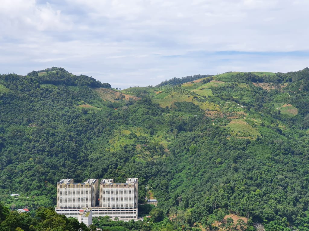
Looking towards the hills on the other side of the Paya Terubong valley.
Advertisement

MENTION HILLS ON Penang Island, and Penang Hill and its greater range comes to mind; this starts at the southwest tip, winds its way along the middle, and broadens out to a large hilly area as it approaches the north and north-west side of the Island. This main range is visible from miles away, and defines the skyline of the island. However, a few other secondary hill ranges and isolated peaks do exist on the island, the most prominent of which is situated in the backdrop of Gelugor—often referred to as the Bukit Gambir hills. Visible from the first Penang Bridge, most people do not realise that this is a separate range; when viewed from that direction, it melds into the higher Penang Hill range behind it.

Eight of the peaks along the Trans Nine Peaks hike. The 9th peak, Bukit Jambul, is not visible from this angle.

This lesser range starts near the Penang Golf Club in Bukit Jambul and runs all the way to the sprawling Batu Lanchang Cemetery, stretching approximately 8km, and forming a natural geographic boundary between Gelugor and the narrow Paya Terubong Valley. Despite looking lush and green from afar, not all of it is forest; large areas of the hill range are privately owned fruit orchards. Vestiges of forest are restricted to narrow slithers along the ridge top and steep sections along the range. In fact, this agricultural legacy goes back a long time—maps from the 1850s already show large “spice plantations” occupying the slopes of the Bukit Gambir hills. One of these “spice plantations” belonged to James Richardson Logan, a 19th century Penang lawyer and polymath, whose monument stands in front of our Supreme Court. Logan is credited for popularising the term “Indonesia” to refer to the Malay Archipelago well before our neighbouring nation adopted the name.

Pale Reed Orchid (Bromheadia finlaysoniana).

A plethora of trails run through the hill range, with popular ones being Bukit Jambul and Bukit Kukus. The “Trans Nine Peaks” walk became popular in 2018 when a few ambitious hikers connected the few separate trails along the range into a single, continuous seven-hour walk, starting at BL Garden in Solok Thean Teik (near Batu Lanchang Cemetery) and ending at Bukit Jambul. The name references the nine peaks one crosses during this hike: Bukit Kecil, Bukit Batu Lanchang, Bukit Hijau, Bukit Romania, Bukit Relau, Bukit Botak, Bukit Paduka, Bukit Kukus and Bukit Jambul.

The rock formations which seemed to defy gravity.

As word spread about this trail, it became a hit among the local hiking community. However, its popularity was short lived; by 2021, sections along the walk had become inaccessible due to land works for agriculture. In 2022, the northern section, near BL Garden, was cut off due to works on the Ayer Itam-Tun Dr. Lim Chong Eu Expressway Bypass. As it stands in 2025,this walk is no longer possible to attempt in its entirety. Only sections can be accessed.

Having completed this trail in December 2020, this account by me serves not as a guide—as is typical of my other articles in the “Peaks and Parks” column—but as a nostalgic recollection and an accomplishment.

We started along a cement path just off BL Garden. Very quickly, it led us onto a jungle trail going upward. Clambering up the steep slope, a gleaming red signboard informed us that we were on the “Trans Nine Peaks Trail”, with the first peak, Bukit Kecil, just a few steps ahead. The term “Trans” within the hiking community is used to denote a hike which traverses multiple peaks, or one that passes along a long ridge.

Walking through farms in the Sungai Jelutong valley.

On Bukit Kecil, a large Ficus tree greeted us. The trail then led southward, and in just 10 minutes, we had reached the second high point, Bukit Batu Lanchang. Along the ridge, the rock formations were a fascinating sight—some seemed to defy gravity. It took another 15 minutes to arrive at Bukit Hijau, a popular hiker’s haunt. At this point, the hike felt deceptively easy, three of the nine peaks conquered in less than an hour. However, a glance at our GPS maps reminded us that much of the journey still lay ahead. We paused at Bukit Hijau to soak in the breathtaking view of the Paya Terubong Valley, framed by the towering Penang Hill range.

An ant mount along the way.

Rested and rejuvenated, we continued to Bukit Romania. The name might evoke curiosity about a connection to Eastern Europe, but in reality, this peak is named after the edible Bouea oppositifolia fruit, locally known as “Romania”. From Bukit Romania, the trail descended into a farm, where a few feisty geese greeted us with evident displeasure. At this point, we were surrounded by lush farms. This is the Sungai Jelutong valley, a small river valley enclosed within the Bukit Gambir hills. To our east, the densely wooded Bukit Delima rose, while in front of us, our next challenge, Bukit Relau, awaited. The trail wound its way up the valley to the source of Sungai Jelutong before taking a sharp right into the jungle. This section proved muddy and exhausting, but the installed ropes along the path were a lifesaver, helping us through. After 45 minutes, we arrived at the Tai Kar Luck rest spot.

The Tai Kar Luck rest spot.

A large Ficus tree on Bukit Kecil.

After taking a good rest, our journey continued towards Bukit Relau. This section of the walk rose steeply, following the shoulder of the hill through dense jungle. As we approached the summit about an hour later, the forest became sparser, opening up towards the summit ridge, which had been deforested more than a decade ago. There was not much of a view at the summit, and we began our steep and quick descent into a col, where a recently established durian orchard was located. From here, there was an uninterrupted view both towards the farms of the Penang Hill range on the west and Pulau Jerejak on the east. A wide cement road wound its way through much of the farm and we followed this path to the other side of the col to Bukit Botak. Bukit Botak, translated as “Bald Hill”, got this name due to extensive clearing that had left its summit barren.

The breathtaking view of the Paya Terubong valley framed by the towering Penang Hill range, seen from Bukit Hijau.

This section tested our stamina; the scorching heat and steep cement road drained our energy. Fortunately, the trail beyond Bukit Botak was shaded by large trees, and we were back in the forest, with lianas clambering up into the canopy and a gentle breeze giving us much-needed respite. This section was mostly gentle as we trudged towards the 7th and 8th peaks—Bukit Paduka and Bukit Kukus. Bukit Kukus, towering at 426m above sea level, is the tallest peak in the Bukit Gambir range. By the time we reached Bukit Kukus, we had been hiking for close to six hours, with only one more peak until the completion of the “Trans Nine Peaks”. Bukit Kukus is also well known for another reason—the Voo-doo Lily (Amorphophallus prainii), which grows in abundance there. Wearied but determined, we forged on to Bukit Jambul, first descending steeply from Bukit Kukus before ascending once more.

Geese spotted in a farm along the trail.

After seven hours and a distance of 10km, we triumphantly bagged the “Trans Nine Peaks”! This unforgettable hike offered a diverse tapestry of scenery—from lush forests and thriving orchards to open expanses, with great views in all directions. Though no longer fully accessible, the tales of those who had completed the trail endure as a cherished memory.

Looking towards the first Penang Bridge from the summit ridge of Bukit Relau.

The flower of the Tacca Bat Lily (Tacca integrifolia).

A red signboard on Bukit Kecil with the list of peaks along the Trans Nine Peaks hike.

The Voodoo Lily (Amorphophallus prainii), which grows in abundance on Bukit Kukus. They flower in the months of April to May each year.

Looking back at Bukit Relau from Bukit Botak.

The lush forest scene on the ridge towards Bukit Kukus.

The Trans Nine Peaks trail snapshot captured on Strava (smartphone hiking application).

The Trans Nine Peaks trail close-up snapshot captured on Strava (smartphone hiking application)

Rexy Prakash Chacko

is an electronic engineer by profession and a nature lover by passion. While he spends his weekdays earning a living at the Bayan Lepas Free Industrial Zone, his weekends are spent reflecting and recharging on the green hills of Penang.


`